 MartinShields
On a tight grading job, a GPS-guided excavator can follow the digital design as you shape the ground, reducing guesswork and costly corrections. You can see the bucket’s position against the target grade in real time, helping your crew place material more accurately and keep work moving. But reliable results depend on more than the machine’s display; the setup details can make or break your next earthmoving project.
Key Takeaways
- GPS-guided excavators show operators the bucket’s real-time position and target depth, reducing guesswork and unnecessary digging passes.
- Digital site models translate design plans into clear cab guidance, helping operators match grades and excavation boundaries accurately.
- Precise grading reduces overcutting, rework, and soil rehandling, helping crews finish faster and keep projects on schedule.
- Real-time guidance improves coordination with follow-on work, while utility checks, spotters, and safety protocols remain essential.
- Reliable results depend on current design data, trained operators, clear satellite reception, and regular calibration and equipment checks.
How Do GPS-Guided Excavators Work?
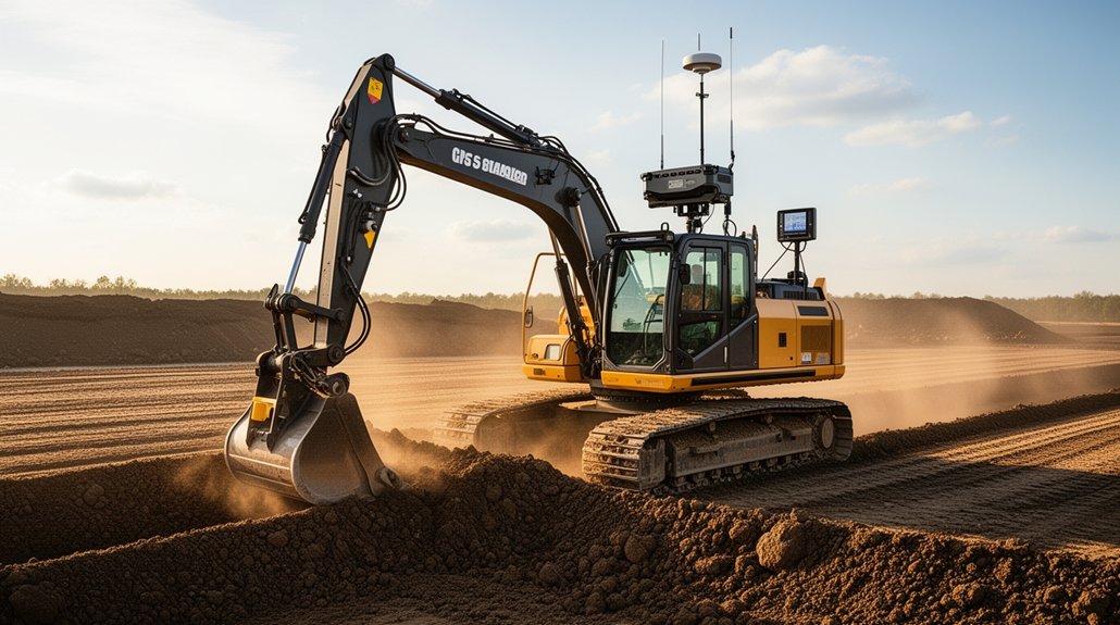
GPS-guided excavators use satellite positioning, onboard sensors, and a cab display to show where the bucket sits relative to the digital site plan. Sensors track boom, arm, and bucket movement, while the positioning system updates the machine’s location as you work. The display gives you live measurements, so you can control digging depth and reduce unnecessary passes around foundations, utilities, and landscaping.
Before starting a renovation project, check Machine calibration against the excavator’s attachment and verify sensor readings. Accurate setup helps you avoid overdigging and costly rework.
Trees, buildings, and other obstacles can cause signal interference, so watch for unstable readings and pause if positioning becomes unreliable. Your operator should understand the system’s alerts and confirm measurements with site checks when needed.
GPS supports precise machine operation; it doesn’t replace sound judgment or safe excavation practices.
How Do Digital Plans Guide Excavation?
Digital plans turn design elevations and excavation boundaries into clear targets on the cab display. For a renovation, you can use them to match proposed levels to existing structures, protect service routes, and shape drainage falls accurately.
Digital mapping converts survey information and design drawings into a site model your operator can follow while digging. Terrain modeling shows how the finished surface should meet foundations, paths, or retaining walls, helping you spot awkward transitions before you remove material.
As you excavate, the display compares the bucket’s position with the planned surface, so you can adjust depth and avoid unnecessary cuts or costly rework. You’ll also keep the crew working from one consistent design, making it easier to coordinate staged excavation and verify that each area meets the renovation plan.
What Does GPS Guidance Need to Work?
To use those digital plans in the cab, you’ll need reliable satellite reception, a calibrated machine, and an accurate site model. Satellite connectivity links your excavator to positioning signals, so check that the antenna has a clear view of the sky and that nearby buildings, trees, or structures won’t block reception.
Before work begins, load the correct project files and confirm they match the renovation plans and site conditions.
System calibration aligns the machine’s sensors, boom, stick, and bucket with the guidance system. Have a trained technician complete the setup, then verify measurements at known points.
Keep cables, antennas, and displays secure and in good condition. If you move the machine or change attachments, check the setup again; accurate inputs help you work confidently within the planned excavation area.
How Do Accurate Grades Reduce Rework?
Accurate GPS grades help you avoid cuts and fills that miss the renovation plan. You’ll rehandle less material because the excavator places soil closer to its final elevation the first time.
You can also check finished grades faster and correct any deviations before they delay the next phase.
Fewer Grading Errors
When GPS-guided excavators follow the design grade, crews are less likely to overcut, leave high spots, or reshape the same area twice. During renovation, that accuracy helps you bring existing surfaces to the required elevation without disturbing more ground than necessary. You can check the machine’s position against the digital plan as you work, correcting deviations before they become costly grading errors.
Confirm equipment calibration before excavation, and verify the site model against current measurements; outdated references can still produce an inaccurate finish. Accurate cuts also help you prepare a consistent base for the next construction layer. Where the design calls for it, you can achieve the specified soil compaction without repeatedly reshaping the surface.
Less Material Rehandling
Precise grading also reduces the need to move soil more than once. When you follow GPS design data, you can cut and fill to the required elevations on the first pass. That means less material handling, fewer haul cycles, and lower fuel use across your renovation site.
You’ll also avoid building excess soil into areas that later need trimming or importing replacement material after over-excavation.
Before work begins, confirm your control points and complete equipment calibration so the machine’s position and bucket guidance match the project plan. Keep the design surface current if site conditions or renovation details change; outdated data can send you back to rework finished areas.
Faster Quality Checks
With GPS-guided grading, you can check elevations against the design as you work instead of waiting for a separate survey. On a renovation site, that immediate feedback helps you catch high spots, shallow cuts, and drainage errors before they’re buried beneath new pavement or landscaping.
You can correct the grade while the excavator is already in position, rather than bringing crews back to reopen finished areas. Accurate checks also help you confirm that tie-ins meet existing structures and surfaces, reducing costly adjustments later.
By limiting rework, you protect material management plans and avoid wasting aggregate, fill, or disposal capacity. You can also keep project scheduling on track because fewer surprises mean fewer delays for follow-up surveys, additional equipment, and subcontractors.
Your crew finishes each area with greater confidence and fewer callbacks.
How Do GPS-Guided Excavators Save Time?
GPS-guided excavators save time by showing operators exactly where and how deep to dig, reducing guesswork and rework. During renovation, you can remove only the material needed, protect existing structures, and keep work moving without repeated checks against plans.
The display gives you real-time guidance, so you can reach the required grade in fewer passes and avoid correcting over-digging with extra fill.
To get reliable results, complete equipment calibration before work begins and verify operator training covers the control system and site model. Your crew can then follow design elevations, adjust promptly when conditions change, and coordinate excavation with the next renovation tasks.
Clear guidance also reduces time spent waiting for measurements or clarifying instructions. You’ll finish each dig more predictably, with less machine idling and fewer schedule delays.
Where Does GPS Guidance Pay Off Most?
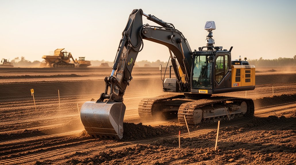
GPS guidance pays off most on renovation sites where tight access, existing utilities, or fixed elevations leave little room for error. When you reshape a courtyard, replace drainage, or connect an addition to an existing foundation, accurate cut-and-fill targets help you match plans without repeated checks. You’ll get the greatest return where design tolerances are tight, work areas are confined, and rework would disrupt occupied spaces or other trades.
Use Cost analysis to compare setup and survey expenses with reduced overdig, material hauling, and correction work. GPS can also limit unnecessary excavation and truck movements, lowering fuel use and environmental impact.
On broad, uncomplicated sites, the savings may be smaller. Before mobilising, review your plans, machine access, and project quantities to confirm guidance addresses a real renovation constraint and fits your budget.
How Do GPS-Guided Excavators Improve Safety?
On renovation sites, GPS-guided excavators can help you keep people and equipment clear of hazards by showing the bucket’s position and planned dig limits in the cab. You can avoid striking marked utilities, foundations, or retained structures by checking the display before each pass.
Guidance also helps you maintain safe setbacks from occupied buildings and unstable edges, especially where visibility is limited. It won’t detect every person or hazard, so keep spotters in place and follow site safety protocols.
Confirm utility locations, establish exclusion zones, and stop work when conditions change. Operator training matters: make sure you can interpret alerts, verify machine position, and respond to unexpected readings.
Use GPS as an added layer of awareness, not a substitute for direct observation, communication, or sound judgement around workers and property.
How Can Crews Get the Most From GPS Guidance?
To get the most from GPS guidance, start with accurate site data and a clear dig plan. Before renovation begins, check that your design files match current site conditions, utility locations, and required grades. Outdated plans can send your bucket off course and create costly rework.
Prioritise Crew training so operators can read displays, interpret cut-and-fill information, and respond to changing conditions. Give each operator time to practise on the machine they’ll use, and set clear procedures for updating plans or flagging discrepancies.
Schedule Equipment calibration before work starts and after sensor repairs or machine changes. Verify antenna positions, bucket dimensions, and reference points against a known benchmark.
During excavation, compare guidance readings with physical checks at key stages. Keep displays clean, protect cables, and report faults promptly. Regular checks help you maintain accuracy, limit material waste, and finish renovation work to specification.
Conclusion
With a GPS-guided excavator, you can turn digital plans into accurate grades, place material efficiently, and catch errors before they trigger costly rework. Keep your site data current, calibrate the system, and maintain your equipment so guidance stays reliable. Train your crew to use the displays confidently, and you’ll improve coordination and safety while moving faster. It’s a bit like giving your excavator a crystal ball—but the real advantage comes from sound planning and skilled operators.